I'm in!
But I've only done this a few times and only went down the backside to Sok Kwu Wan once, usually using the easier and more familiar route that ThomasL describes above.
Could we find somebody who knows the way down or, even better, up from Lo So Shing? There are detailed maps on the Govt, maps website (much more detailed and up-to-date than Centamap I've used before):
http://www2.map.gov.hk/gih3/view/index.jsp
There's a mobile phone version, much more detailed than Google maps, and together with the GPS in many mobile phones and good mobile coverage even on top of Mt. Stenhouse, we shouldn't get lost:
http://www.map.gov.hk/mobile.
But many of these paths don't really exist anymore, totally overgrown. I found that out the hard way, trying to follow some paths on the govt maps into the totally wild, uninhabited hills beyond Mo Tat Wan. Even with the help of my smartphone maps and GPS I found most of the paths had become totally overgrown due to nobody using them anymore.
So who's a bit familiar with the path from Mt. Stenhouse to Lo So Shing? I'd suggest to use that for either going up or down, using the familiar, mostly-used path via the pavilion for the other half of the hike.
I also just bought the large printed map of Lamma Island that Alan recommended a few weeks ago. Useful, but by far not as detailed and up-to-date as the online maps, of course.
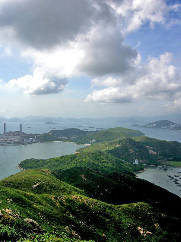
The weather is perfect for hiking now and if we catch a good-visibility day, the views should be spectacular, something like this photo below, courtesy of Wang Hong.
But this is NOT a trip for tourists and casual hikers, there's some mild climbing involved and you might have to carry any dogs coming along (most welcome) for short distances over big boulders. Long sleeves, long trousers to avoid scratches and serious footwear are strongly recommended.
Lamma-zine story and photos about my first climb:
http://www.compunicate.com/Lamma-zine/Blog/Blog-2009-01.html#Jan24
How about Sat, Feb 18, anyone?